Kouga’s total output/Gross Value Added (GVA), which is used to measure the value of production in a region, has shown erratic growth since 1996. Regional Income and Production Data for 1995 to 2010 (Stats SA) indicates that the economic sector of Kouga is dominated by secondary and tertiary activity. In 2010 the leading industries were finance, insurance and real estate (FIR) at 33,3%, manufacturing (MAN) at 19,1% and general...
Read MoreKouga is largely a suburban area, with three main topographical regions: The coastal region stretches from the Tsitsikamma River in the west to the Van Stadens River in the east. This zone includes the towns of Oyster Bay, St Francis Bay and Port St Francis, Cape St Francis, Jeffreys Bay and the Gamtoos River Mouth. The coast serves as a major tourism attraction. The Gamtoos River Valley is characterised by wide, fertile flood plains...
Read MoreDespite the Kouga being the second smallest region in the Sarah Bartmann District, covering only 4,1% of the district’s land area, it has the largest population of 98 588 (Census 2011), which represents approximately 22% of the total population of the district. Kouga also has the fastest annual growth rate in the district. Since 1996, the population has increased at an average of 2,4% per annum compared to the annual growth rate of...
Read More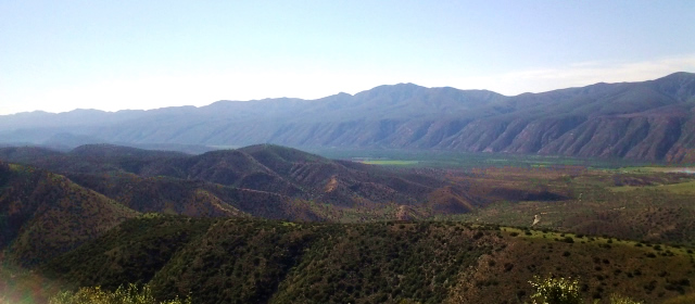
The Baviaanskloof (Valley of Baboons) is literally a kloof nestled between the Baviaans Mountain Range to the north and the Kouga Mountain Range to the south, along which a road crosses a series of at least 100 low water crossings.
Read MoreThornhill is situated amongst rolling hills and mountains that characterise the farmlands and countryside of the Eastern Cape. While most of the local community is economically challenged, they enjoy spectacular surrounds, and often find work on the smallholdings and farms that are dotted around the landscape.
Read More